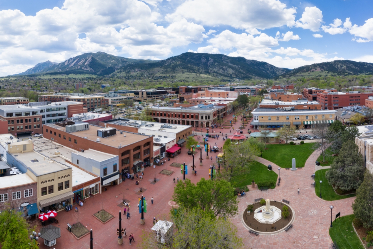
15 Best Hikes Near Boulder, Colorado for All Abilities
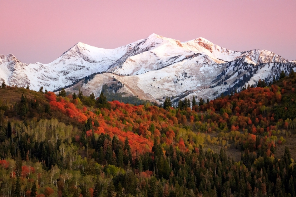
Finding a place more beautiful than the Rocky Mountains is rare. Where the desert meets the plains, the city of Boulder offers the unique opportunity to explore this stunning and diverse landscape.
Tucked away in the hills are lush meadows, sandy canyons, and majestic mountain peaks just waiting to be discovered, hiking is one of the best things to do in Boulder.
There are seemingly unlimited hiking trails to navigate here so I decided to make this guide to the best hiking trails near Boulder Colorado.
1. First and Second Flatirons Loop
Distance: 2.7 mi / 4.3 km
Time: 2 Hours 30 Minutes
Elevation gain: 1,450 ft / 442m
Difficulty: Moderate
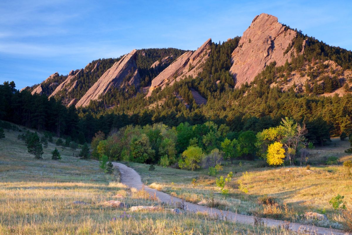
The Flatirons are the most recognizable feature in Boulder’s landscape. Journeying through the foothills of the iconic sandstone rock formations is the quintessential northern Colorado experience.
The loop starts in a calm meadow at the base of the flatirons. The trail is an old fire road surrounded by overgrown trees and shrubs before the ascent into the forest begins.
Once you reach the peak of the flat irons, you will be rewarded with incredible panoramic views of the north range of the Rocky Mountains
How to Get to the Flatirons Loop
This hike begins at the Gregory Canyon Trailhead in Chautauqua Park, located in the foothills of southwest Boulder.
There is a large dirt parking lot off Baseline Road. Non-Boulder residents are required to pay a parking fee which can be paid at the trailhead or the Chautauqua Park Rangers Cottage.
2. Bear Peak Summit via Shanahan Ridge
Distance: 5 mi / 8 km
Time: 4 Hours 15 Minutes
Elevation gain: 2,674 ft / 815 m
Difficulty: Difficult
Shanahan Ridge is a challenging trek but the panoramic views from atop Bear Peak Summit are well worth the effort. With over 2,500 feet of elevation gain, the arduous climb to the peak is not for the faint of heart.
This epic summit adventure wanders through a dense ponderosa pine forest before beginning the sharp climb to the peak. Once breaching the timberline, the trail transforms into a long and rocky cliffside until you reach the summit of craggy Bear Peak.
How to Get to Bear Peak Summit
This hike begins at the Shanahan Road Trailhead in Table Mesa. You can find the trail parking area tucked away on Lehigh Street in a residential area.
3. Boulder Falls
Distance: 0.3 Miles / 0.5 km
Time: 10 Minutes
Elevation gain: 52 ft / 16 m
Difficulty: Easy
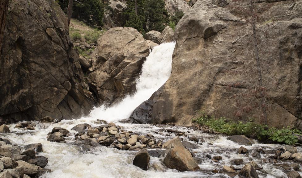
Boulder Falls is a short journey to a huge payoff. While it only takes a few minutes to reach the powerful waterfall, be sure to take some time to enjoy the cool mist of the crashing falls, seldom found in this dry climate.
The trail leads you between paralleling cliffs through a wide-notch pathway. After about 100 yards through giant ponderosa pines, you will reach the breathtaking shores of the 70-foot tall, torrentially cascading Boulder Falls.
How to Get to Boulder Falls
To find this trailhead, head west for about 9 miles on Highway 119. The trailhead parking area is on the left; however, the trailhead will be on the right.
Use caution when crossing Highway 119, it can be busy at times.
4. Boulder Mesa Trail
Distance: 13.2 mi / 21 km
Time: 6 Hours 30 Minutes
Elevation gain: 2,904 ft / 885 m
Difficulty: Moderate
A stunning hike suited for the most ambitious of hikers. The long journey through the stunningly diverse region of the Boulder foothills is well worth the effort.
Unlike other hikes in this guide, the Boulder Mesa Trail is not about the destination, but the adventure.
The pathway traverses along a lush desert plateau into the furthest reaches of the northern range. If a peaceful trek is your inspiration, the expansive Boulder Mesa Trail rarely disappoints.
How to Get to Boulder Mesa Trail
This trailhead is found in Chautauqua Park, located in the foothills of southwest Boulder.
There is a large dirt parking lot off Baseline Road. Non-Boulder residents are required to pay a parking fee which can be paid at the trailhead or the Chautauqua Park Rangers Cottage.
5. Green Mountain West Trail
Distance: 3.8 mi / 6.1 km
Time: 1 Hour 50 Minutes
Elevation gain: 682 ft / 208m
Difficulty: Moderate
Reach the peak of Boulder’s most manageable summit hike. Green Mountain is arguably one of the easier summit hikes in Colorado but climbing this mountain is no picnic. However, with the short distance and limited elevation gain, an average hiker may reach the summit.
This out-and-back hike begins as a mild climb through the forest and quickly ascends. After about a mile of steady incline, the trail transforms into a series of switchbacks before revealing the panoramic views from this rocky summit.
How to Get to Green Mountain West
Head west on Flagstaff Road for 4.6 miles and there will be a small parking area on the left. The trailhead can be found on the east side of the parking area.
6. Mount Sanitas and Sanitas Valley Loop Trail
Distance: 3.2 mi / 5.1 km
Time: 2 Hours 15 Minutes
Elevation gain: 1,257 ft / 383 m
Difficulty: Challenging
This hike is a wonderful, but challenging journey with an incredible payoff. Mount Sanitas and Sanitas Valley Loop Trail is a pair of connected trails that ultimately lead to an incredible lookout point of the Rocky Mountains front range.
For an easier trek, start at the Sanitas Valley Loop Trailhead. From here, the elevation gain is mild. However, due to the accessibility of this section, it can be remarkably busy. Be sure to arrive early.
How to Get to Sanitas Valley
This hike begins about 2 miles west of Boulder off Sunshine Canyon Drive. Look for the parking area for the Centennial Trail on the left. Take the Centennial Trailhead and you will find the Mount Sanitas Valley Loop Trailhead after a short walk.
7. Royal Arch Trail
Distance: 3.4 mi / 5.5 km
Time: 2 Hours 30 Minutes
Elevation gain: 1,470 ft / 448 m
Difficulty: Challenging
A beautiful hike through Bluebell Canyon that culminates with Boulder’s iconic Royal Arch. While the arch is not nearly as grand as the ones you may find in Utah, Royal Arch is still a remarkable sight.
With the rolling nature of the canyon, the trail accumulates elevation quickly and often. The Royal Arch section is narrow and can quickly become crowded. To capture unobstructed photos, arriving as early as possible is important.
How to Get to the Royal Arch
This trailhead is found in Chautauqua Park, located in the foothills of southwest Boulder. There is a large dirt parking lot off Baseline Road. Non-Boulder residents require a parking fee which can be paid at the trailhead or the Chautauqua Park Rangers Cottage.
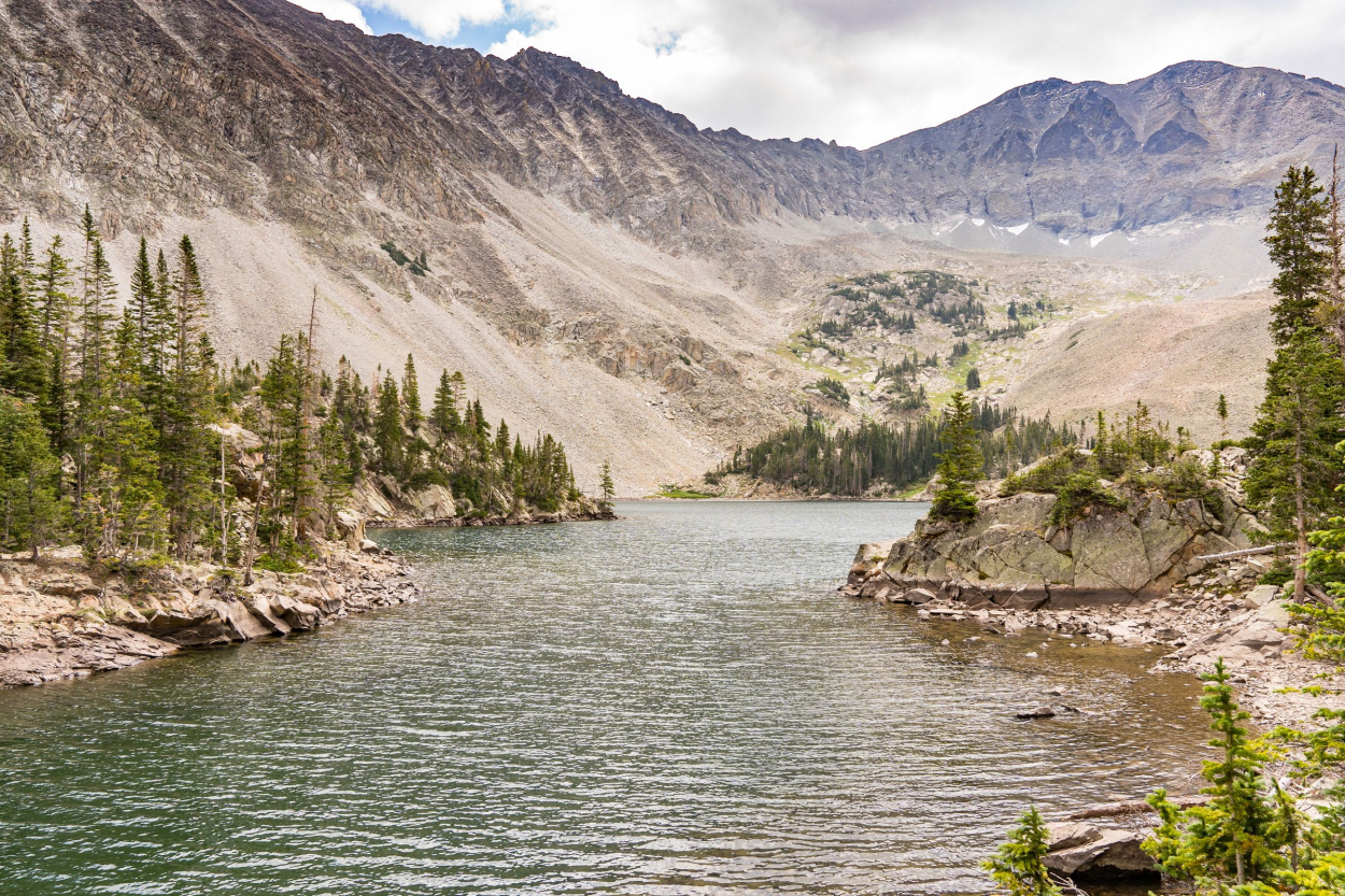
8. Lost Lake via Hessie Trail
Distance: 4 mi / 6.4 km
Time: 2 Hours
Elevation gain: 830 ft / 253 m
Difficulty: Moderate

Lost Lake is a family-friendly hike through the pristine Denver wilderness. This is a moderate high-altitude hike that wanders along a rocky ridge paralleled by seasonal snowcapped mountains.
The hike can be enjoyed during all seasons and with a comfortable surface and a mild climb throughout, this trail is suitable for hikers of all skill levels. But check out my other guide if you are wondering what is the best time to visit Colorado.
For a unique adventure, visit during the fall to witness the fall foliage changing from Lost Lake’s shores.
How to Get to Lost Lake
Take CO-119 West through Boulder Canyon for 21.2 miles. Once passing through Nederland, look for signs for Hessie Trailhead – the parking area will be on your right.
9. South Boulder Peak via Homestead Trail
Distance: 8 mi / 12.9 km
Time: 5 Hours and 20 Minutes
Elevation gain: 2,881 ft / 878 m
Difficulty: Challenging
A challenging summit through Boulder’s most iconic natural landmarks. As you explore this trail, you will encounter the flatirons, Fern Canyon, South Boulder Peak – and if you are feeling bold, Bear Peak.
Homestead trail consists of a network of connected trails that lead to South Boulder Peak. Be sure to plan your route as it is easy to find yourself on the wrong pathway, sapping the energy you will want to have for this difficult climb.
From the summit, you can continue climbing the ridge for an additional 0.7 miles to reach the panoramic views of Bear Peak.
How to Get to Boulder Peak
To find this trail, head southwest on CO-93 S for 5.1 miles and turn right onto El Dorado Springs Drive. After 1.7 miles, look for the South Mesa Trail parking lot on the right. The trailhead is found on the north side of the parking area.
10. Chautauqua Trail
Distance: 1.2 mi / 1.9 km
Time: 45 minutes
Elevation gain: 420 ft / 128 m
Difficulty: Moderate
An awesome trek through the wilderness along the foothills of the flatirons. This family-friendly path is a brief day hike into the most beautiful sections of Boulder’s foothills.
The Chautauqua Trail is an interpretive experience. Along the way, you will find educational signage identifying and exploring Boulder’s natural history.
Bring your camera – this pathway opens to multiple scenic vistas of the ragged flat irons that are waiting to be captured.
How to Get to the Chautauqua Trail
This trailhead is found in Chautauqua Park, located in the foothills of southwest Boulder. There is a large dirt parking lot off Baseline Road. Non-Boulder residents require a parking fee which can be paid at the trailhead or the Chautauqua Park Rangers Cottage.
11. Gregory Canyon, Rangeview, and Flagstaff Trail Loop
Distance: 3.8 mi / 5.8 km
Time: 2 Hours 20 Minutes
Elevation gain: 1,198 ft/ 365 m
Difficulty: Moderate
The path through Gregory Canyon is an impressively diverse journey in the Boulder area. The hike is non-linear, with multiple connecting trails to a variety of unique Coloradan landscapes.
Once leaving the canyon, the trail connects to Rangeview Trail – a steep set of switchbacks along the foothill ridge.
Follow this until you can connect to Flagstaff Trail Loop. This trail will lead above the front range with outstanding views of Boulder’s peaks and the surrounding Rocky Mountains.
How to Get to Gregory Canyon
To find this trailhead, head west on Baseline Road until it becomes Gregory Canyon Road. After a short drive, there will be a parking circle where you can leave your vehicle. Be sure to take the Gregory Canyon Trailhead for multiple trails begin here.
12. Mallory Cave
Distance: 3.1 mi / 5 km
Time: 2 hours
Elevation gain: 1,171 ft / 357 m
Difficulty: Moderate
Take this short journey to explore the protected Mallory Cave. The elevation profile is not that difficult, but the surface can be jagged and rocky – be sure to wear appropriate footwear.
Mallory Cave rests near the summit of Dinosaur Mountain. The cave is closed year-round to protect the fragile bat ecosystem that lives within but the summit of Mallory Cave is a short rock scramble and lends fantastic panoramic views of the front range.
How to Get to Mallory Cave
The best way to find this trailhead is to follow Table Mesa Drive west until you reach the NCAR Parking Area. The hike leaves from the NCAR trailhead in the parking lot.
13. Walker Ranch Loop
Distance: 7.9 mi / 12.7 km
Time: 4 Hours
Elevation gain: 1,375 ft / 419 m
Difficulty: Moderate
Walker Ranch Loop is an enchanting hike through the meadows of Boulder’s foothills. This combined multipurpose trail is a comfortable trek that explores South Boulder Creek, unique rock formations, and diverse wildlife.
Walker Range connects four trails – Columbine Gulch, Eldorado Canyon, Crescent Meadows, and South Boulder Creek. The expansive meadows were the result of a forest fire that created an entirely new and diverse ecosystem, making this trail incredibly unique.
How to Get to Walker Ranch
To reach this trail, take the winding Flagstaff Road into a canyon for 7.2 miles. The road will end with the parking area for this trail.
14. Lion’s Lair Spur Trail
Distance: 4.1 mi / 6.6km
Time: 2 hours
Elevation gain: 827 ft / 252 m
Difficulty: Moderate
An incredibly scenic hike through the heart of a lion’s den. While generally harmless, mountain lions frequent these surrounding foothills.
This spur trail travels deep into a lush ponderosa pine forest before transforming into a rocky and exposed ridge side climb. The hike culminates with beautifully expansive 360-degree views atop Mount Sanitas.
How to Get to Lion’s Lair
Head west down Sunshine Canyon Drive for 1.8 miles to find the trail. Around a tight bend, you will see a small dirt pull-off on your right – this is the parking area for this hike.
15. Skunk Canyon and Kohler Mesa Loop
Distance: 2.8 mi / 4.5 km
Time: 1 Hour 25 Minutes
Elevation gain: 587 ft / 179 m
Difficulty: Moderate
The Skunk Canyon and Kohler Mesa Loop is an enchanting walk into nature that leads to an incredible overlook. This hike wanders along expansive grasslands before entering a ponderosa pine forest.
The dense forest provides an aromatic adventure within the pines, eventually opening to an amazing backcountry vantage point of the iconic flatirons.
What’s more, this trail is less traveled, making for a peaceful escape into the wilderness.
How to Get to Skunk Canyon
To find this trail, head south on Highway 93 for about 2 miles. Turn right onto Dartmouth Avenue, followed by an immediate left onto Kohler Drive. The road will merge with Deer Valley Road and the parking area will be on your left.