7 Best Hikes Near Colorado Springs (of All Difficulties)
Colorado Springs is full of things to do and amazing hikes. Whether you’re looking for a weekend getaway to the mountains, a place to check off some bucket list items or a family-friendly vacation spot, Colorado Springs may be just what you’re looking for!
While you’re there, don’t miss out on some amazing hiking trails. From quick morning hikes you could do with the family to more challenging hikes for experienced hikers, there are plenty of trails around the Colorado Springs area that will be filled with stunning views and amazing nature.
To help you choose among the many options, I’ve rounded up a list of the best hikes near Colorado Springs below!
1. Garden of The Gods Park
- Difficulty: Easy – Moderate
- Distance from Colorado Springs: 15 mins drive
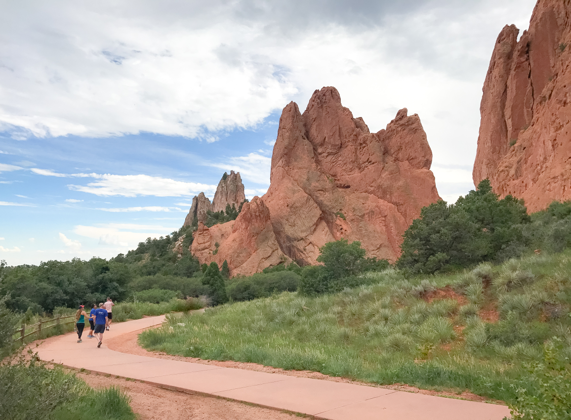
Garden of the Gods is an absolutely stunning area whether you’re driving through or getting out to explore, but this is an especially beautiful place to go for a hike!
The amazing red sandstone formations in this park are an unforgettable sight. While hiking any of the trails here, you’ll be sure to find many scenic views and unique geological formations along your way.
Some of the best trails in the park are:
- Palmer Trail – 1.8 miles / 233 ft elevation gain
- Susan G. Bretag Trail – 0.31 miles / 62 ft elevation gain
- Perkins Central Garden Trail – 1.5 miles / 30 ft elevation gain
Each of the trails here are pretty simple and easy-to-follow hikes and if you want to spend a bit more time here, this is a great place to go camping in Colorado.
As you make your way through the park, keep your eyes out for the Kissing Camels–two rock formations that look just like they’re named. And don’t miss seeing Balanced Rock–a giant red sandstone rock that’s smaller on the bottom than the top and looks like it could tip at any second yet has been standing strong for thousands of years!
How to get to the Garden of the Gods
Drive northwest on Colorado Ave or W Pikes Peak Ave until you reach N 30th Street which will take you to the entrance.
2. Seven Bridges Trail
- Length: 4 miles / 6.5 km
- Elevation Gain: 1,000 ft / 305 m
- Time: 2 hrs
- Difficulty: Moderate
- Distance from Colorado Springs: 25 mins drive
This is one of the most popular trails around the Colorado Springs area and is especially great to hike with kids.
The Seven Bridges Trail leads you along North Cheyenne Creek and along the way you’ll cross over–you guessed it–seven bridges!
You’ll climb about 1,000 feet in elevation over the nearly 4 miles you hike, but the waterfalls and creek along the way make for perfect stopping points to cool down and catch your breath.
Most people complete this hike in about two hours depending on their hiking abilities and how much time you want to spend taking in the views. You’ll also pass Helen Hunt Falls along the path so make sure to stop by and see the beautiful waterfalls!
How to Get to the Seven Bridges
Head south out of Colorado Springs and get on Cheyenne Blvd which will turn into N Cheyenne Canyon Rd. Turn right onto Gold Camp Rd to arrive at your destination.
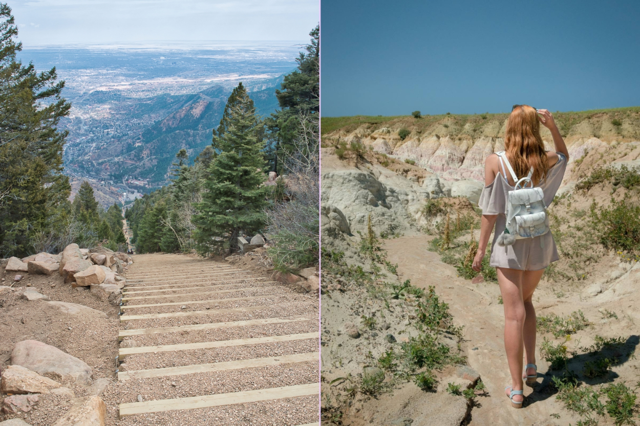
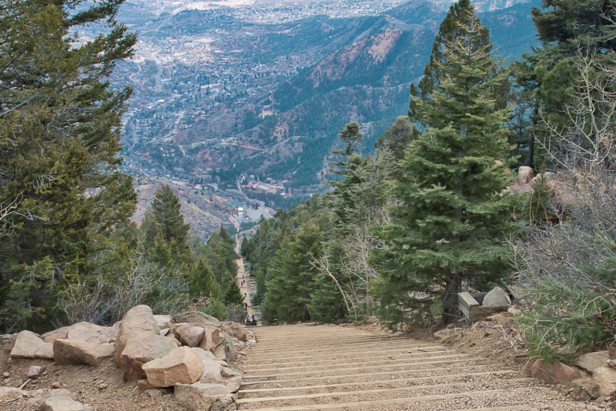
3. Manitou Incline – Manitou Springs
- Length: 0.9 miles / 1.5 km
- Elevation Gain: 1,987 ft / 603 m
- Time: 3.5 hours (whole loop)
- Difficulty: Hard
- Distance from Colorado Springs: 25 mins drive
Looking for a challenge? Then take on “The Incline”! This is a bucket list hike for many hikers and will be sure to test your perseverance and endurance.
Originally this path was built for a cable car to bring supplies up the 2,000-foot mountain, but today, it’s a 2,744-step staircase that brave hikers can climb up for amazing views.
Though it’s only about 0.9 miles, it’s a difficult climb that averages a 41% grade straight uphill. This is a difficult climb so make sure to give yourself time to adjust to the elevation and prepare before hiking.
If you make it to the top, take Barr Trail on the way back to avoid cramming up the stairs and to get even more scenic views over Manitou Springs.
NOTE: This hike requires making a free reservation for the trail as it is so popular. Make sure to do this in advance so you aren’t disappointed.
How to Get to Manitou Incline
To get to the Incline, take the free shuttle instead of trying to find parking on the small residential streets. You can board the Rt. 33 shuttle at Memorial Park just northwest of the city on Manitou Ave.
4. Paint Mines Trail
- Length: 3.4 miles / 5.5 km
- Elevation Gain: 225 ft / 102 m
- Time: 1.5 hours
- Difficulty: Easy
- Distance from Colorado Springs: 45 min drive
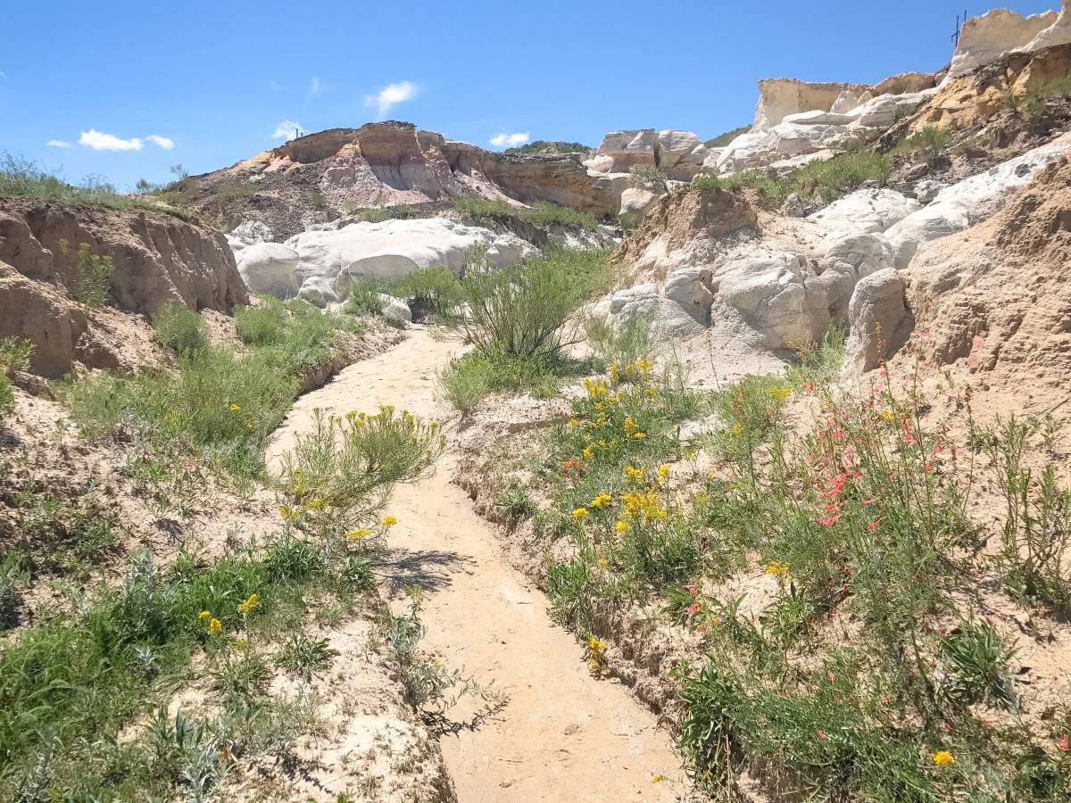
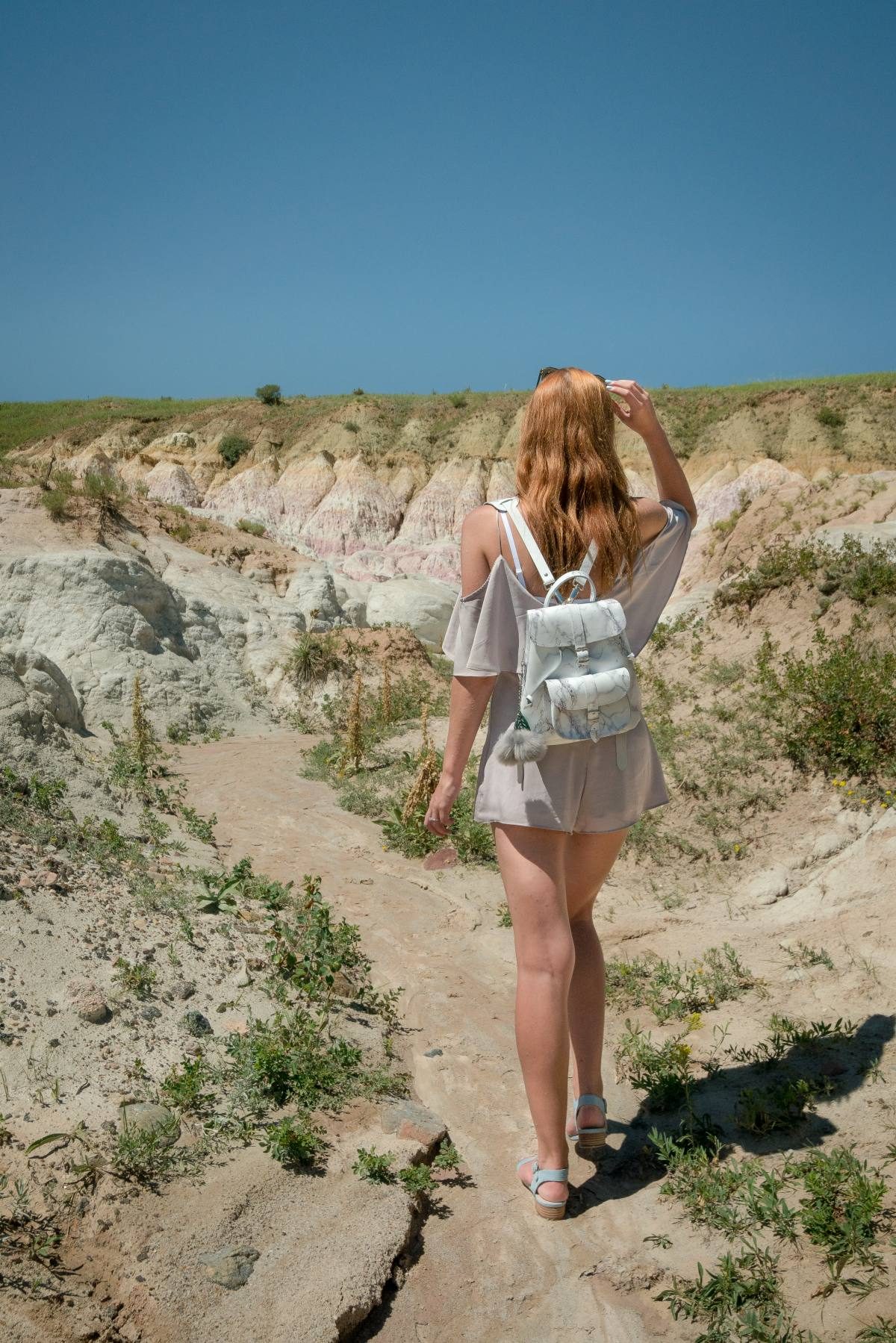
This is a somewhat unknown destination near Colorado Springs, but a very unique and beautiful place to go hiking in the area.
The Paint Mines, named by the American Indians for the paint they collected from the colorful clay, are tucked away about a 45-minute drive from Colorado Springs.
This park is full of amazing geology and history and makes for a fun afternoon of exploring! What exactly is this place? A badlands-type area in the Colorado prairie with colorful layers of white, yellow, and purple rocks is what gives the park its name.
The human impact dates back 12,000 years. They used to live in the caves and settlers later mined the clay to make bricks and color the pottery, dating back 12,000 years. Native Americans also took advantage of these badlands to hunt strategically and chase scared bison herds into this rocky labyrinth where they became easy targets.
In the XXth century, more modern people also took advantage of the park and used some clay for bricks, and ceramics, and got terracotta for local construction projects.
Follow the 3.4-mile trail loop throughout the park to wander through orange, pink, red, yellow, and white colored clay formations looming high above your head.
With all the amazing shades of clay, this is one of the most colorful places in Colorado! Make sure to stay along the trails and refrain from climbing on the rocks as they are fragile and can be easily damaged.
How to Get to the Paint Mines
Drive northeast from Colorado Springs on Hwy 24 until you reach the town of Calhan where you will turn right onto Yoder St then left for Paint Mine Rd.
5. Columbine Trail
- Length: 7.6 miles / 12.2 km
- Elevation Gain: 1,600 ft / 488 m
- Time: 4 hours
- Difficulty: Moderate
- Distance from Colorado Springs: 15 mins drive
This is a moderate hike through Cheyenne Canyon with scenic views and the beautiful Helen Hunt Falls at the summit.
It’s 7.6 miles out and back and usually takes about 4 hours to complete. You’ll climb 1,600 feet in elevation along the way but the views will keep you moving and motivated!
There are three trailheads (lower, middle, and upper). The Lower Trailhead will lead you on the 7.6-mile hike and is the longest, while the Middle and Upper Trailheads have you start further along the path and are shorter in distance.
Pick how long you want to go and head out on this beautiful hike!
How to Get to Columbine Trail
Exit Colorado Springs to the south and get onto Cheyenne Blvd heading southwest. Follow it until you read S Cheyenne Canyon Road which will take you to the trailhead.
6. Red Rock Canyon Open Space
- Difficulty: Easy – Moderate
- Distance from Colorado Springs: 15 min drive
There are a variety of trails in Red Rock Canyon for all different abilities and lengths of hikes.
Choose any of the trails for great views of Pikes Peak and the red rock formations at Garden of the Gods Park located just across the road.
Many of the trails are short and simple but provide a fun hour or two of hiking in beautiful scenery.
Some of the best trails in Red Rock Canyon are:
- The Quarry Trail – 2 miles / 393 ft elevation gain
- Mesa/Greenlee Trail loop – 3.4 miles / 521 ft elevation gain
- Sand Canyon Trail – 1.7 miles / 423 ft elevation gain
Browse the list of trails to choose from at Red Rock Canyon and get outside and enjoy!
How to Get to Red Rock Canyon
Drive the same way as going to the Garden of the Gods (west on Colorado Avenue or Hwy 24) but turn left onto Ridge Rd and then left at the fork for W High St.
7. Seven Falls
- Length: 3 miles / 4.8 km
- Elevation Gain: 771 ft / 235m
- Time: 2 hours
- Difficulty: Moderate
- Distance from Colorado Springs: 15 mins drive
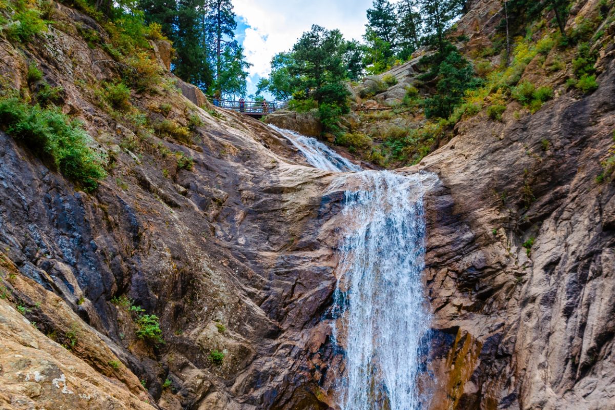
This 3-mile out-and-back trail is located on the grounds of the Broadmoor Resort in Colorado Springs and is a unique and stunning experience. It’s one of the best hikes in Colorado Springs.
First, you’ll go up a 224-step staircase to get to the beginning of the trail and the waterfall. Then you’ll hike to the top of the 181-foot waterfall for incredible views of the waterfall and the surrounding canyon.
Because it’s located on the resort, there’s a $17 ticket required to enter and you’re required to take a shuttle to the start of the trail.
Visit the Broadmoor Website to learn more about visiting Seven Falls, purchase tickets ahead of time, and make sure the park is operating on the day of your visit.
How to Get to Seven Falls
Drive south of downtown on Nevada Ave until taking a right onto Lake Ave. Follow this past the traffic circle and you will be at the Broadmoor Resort.
Tips for Hiking in Colorado Springs
- Remember you are 6,000+ feet in elevation! For even the fittest athlete your body will need time to adjust to the altitude before hiking. Make sure you are hydrated, healthy, and prepared before setting out on any hikes during your trip.
- Colorado Springs is a popular place to visit so it can be hard to find parking at some of the trailheads. Get an early start if you want to beat the crowds and make sure to only park in permitted spaces to avoid damaging the beautiful nature in this area.
- Please protect nature in Colorado by following the “Leave No Trace” rules. Stay on the marked trails, never litter, refrain from feeding any wildlife you see, and be very careful with fire. Let’s keep Colorado beautiful for many years to come!
- This area has plenty of Colorado’s best hot springs, so make sure to take a dip to relax your muscles after a long day outdoors!
- The best time to visit Colorado for hiking is between the end of May and mid-October. However, since Colorado sits at quite a high elevation if your chosen hike is one of the larger mountains, there will probably still be snowy peaks in May so head over closer to June or July.